We
traveled south, still hugging the border of Mexico and hugging the Rio
Grande. When we crossed the border into
Texas we were greeted with a welcome sign.

Well,
all of Texas can’t be that friendly. It’s
a big state.

Has
anyone ever been to MARFA Texas? Well we
have. We made a short stop there to gas
up, use the restroom and get a cold drink.
Marfa was founded in the early 1880s as a railroad water stop. The railroad is still there. In fact the corner gas station we were at was
across the street from the city hall. As
I walked to the corner curb to take this picture, I heard railway crossing
alarm and looked to the left down the street and saw the county court house
just as a train was entering the intersection.
That was our exciting time at Marfa, Texas. Now we can say, “we were in Marfa, Texas!”.


We
have never been to Big Bend National Park and drove into this part of Texas to
visit it. This is the only part of Texas
we will see on this trip. The border of Southern
Texas and Mexico is in the middle of the Rio Grande River. Big Bend National Park is located at this
border where the Rio Grande bends into a U-shape. In other words the park is located at the big
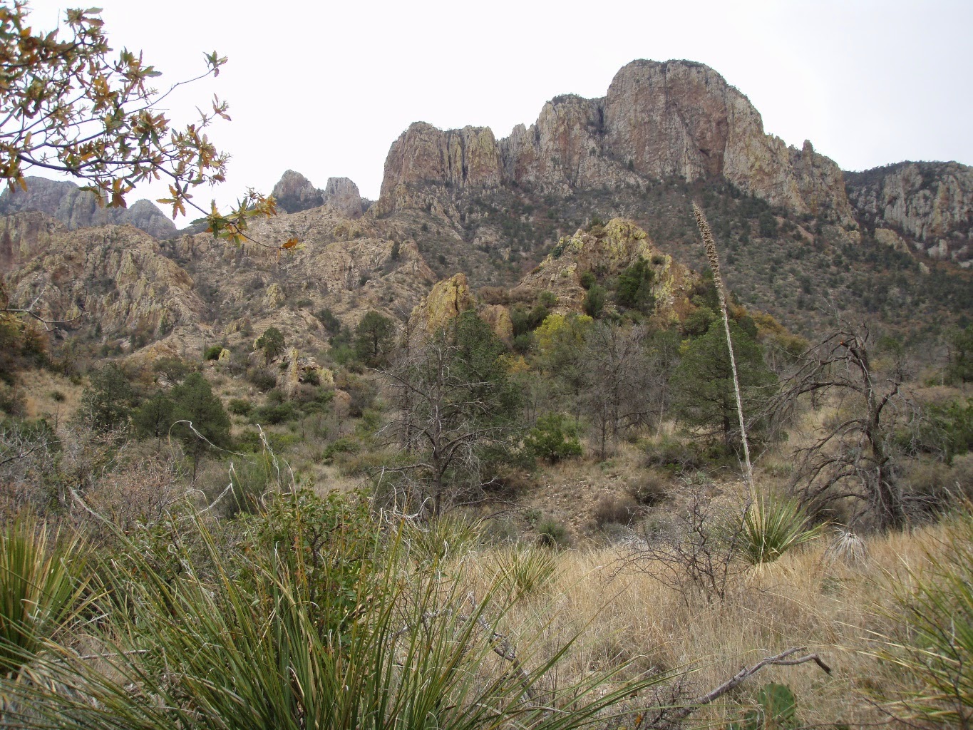
bend in the Rio Grande. This is a huge park that encompasses the entire range
of the Chisos Mountains. The region is
rugged with volcanic rock formations, abrupt pinnacles, dry channels, deep
canyons and desert terrain. Right now
the floor is covered with wild flowers and blooming cactus. It is quite beautiful.

April 3 – 6: We are staying at the Maverick Ranch RV Park at Lajitas
Golf Resort for 4 nights. This a
very nice ‘butterfly’ shaped park with about 100 sites. We have a nice view of the rocks and
mountains. Across the street is the Golf
Resort with a very nice restaurant, saloon with entertainment, bakery and
shops.


Lajitas Golf Resort

Shops on the resort property

On
Easter Sunday we had a nice brunch at the resort restaurant. We sat out on the patio and enjoyed the nice
scenery and had a very relaxing morning.

The
town of Lajitas is a one block town that is dominated by this golf resort. A nearby small airport is for flying in all
the rich people so they can relax in the desert and play golf. It is a colorful town where it’s mayor was a
beer drinking goat named Clay Henry. There
have been a few Clay Henry’s. As Clay
Henry dies, another goat has always been elected as mayor and given the same
name. The original Clay Henry has been
stuffed and is a fixture at the town saloon. The current Clay Henry, who has recently been elected mayor, does not drink beer. But he enjoys orange
soda from a bottle. Clay Henry has a
female companion and both goats are guarded by a cattle dog name Wiley. Wiley is a stray dog that wonders the town
and is taken care of by all the residents.
What a fun town.


BIG BEND NATIONAL
PARK
The
second day of our visit, we drove into the park to the Panther Junction visitor
center. There are 4 visitor centers and
it took us an hour to reach the first one.
There was a lodge nearby and we had a nice lunch there. We spent the rest of the day exploring the park.


OCOTILLO - These plants are not in the cacti family. They are woody and thorny and usually look dead until it rains. When they get full of water they sprout green leaves all over.

 |
| Prickly Pear Cactus |

 |
| Strawberry Pitaya Cactus |


By
the time we got to the Rio Grande Visitor Center, it was closed. This is where the Boquillas Border Crossing is. There is a ferry that takes you across the Rio Grande to Mexico. We wanted to get closer to the Rio Grande to
get pictures. We have been hugging the
Rio Grande on this “On the Border” portion of our trip, but have never seen it
up close. But the burly border guard at
the iron gate said we needed a passport to get through the gate. Even though just walking to the edge of the
river, we would still be on the US side. We still needed our passports (which were in the
trailer).


Boquillas, Mexico
On
our last day we traveled a loop road to explore more of Big Bend National
Park. We started out on an unpaved road,
the Old Maverick Road; to the junction of the Rio Grande at Santa Elena Canyon
and Terlingua Creek. Today we get up
close and personal with the Rio Grande.


 |
As we were doing the short hike from the parking lot to the river, a rush of water from last nights rain storm in the mountains flowed down Terlingua Creek into the Rio Grande; trapping people who earlier were able to walk across the high spots on this creek to the other side (where there was a view point to look further up the Santa Elena Canyon). So we were not able to check out that view point and the people on the other side were stuck on that side for probably about 2 hours until that water stops flowing and the creek recedes.

Rio Grande and Santa Elena Canyon
|
 |
| Terlingua Creek flowing into the Rio Grande. The raging water is from the rainstorms the night before. |


This is where the park ranger is yelling across the river to the
people on the other side explaining that they will have to wait for the river to recede before they could cross over. One guy asked for some beer to be
sent over.
We hiked further up a trail along Terlingua Creek to see the views
and get pictures of some wildflowers.


We
then traveled on a paved road, hugging the Rio Grande, to Castolon Visitor
Center and had a tasty lunch.....


After
lunch we continued onto Ross Maxwell Scenic Drive, completing the loop. We saw some different kind of scenery on this
road; a lot of volcanic ash and of course more wildflowers.


Can you find Slowpoke (above pic)?

 |
| Bluebonnet (Texas state flower). This is growing all over the park. |

Mule Ears Peaks


Our
next destination; back to New Mexico.
No comments:
Post a Comment